
The Yorkshire Dales Escape: 3 Family Walks, Beginner Climbs, and Trail Runs in the Southern Dales
Let’s be completely honest: getting the family out the door for a weekend in the Yorkshire Dales is less of a gentle transition and more of a logistical hostage negotiation. By the time you’ve loaded three changes of trousers (because someone will inevitably find the deepest puddle in Yorkshire), located the exact toy tractor required for survival, packed enough snacks to sustain a minor polar expedition, and successfully wrestled a toddler into a fleece, you’re already exhausted. And you haven’t even navigated the A65 yet.
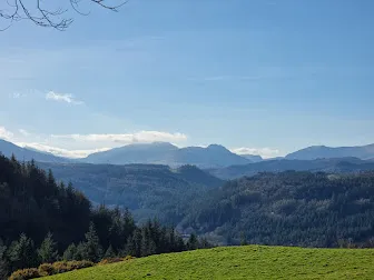
But once you cross the drystone-walled boundaries of the National Park and see the limestone scars sweeping across the green valleys, the pre-trip chaos fades.
The Yorkshire Dales is famous for its rugged terrain, but it is also one of the most welcoming and accessible outdoor spaces in the UK. You don’t need to tackle the full 24-mile Three Peaks Challenge to feel the magic of the fells. In fact, some of the most rewarding adventures are right on the valley floor, or just a short jog from a quiet Yorkshire village.
Here are three route ideas—a scenic, fairy-themed family walk, a classic beginner sport climb, and a solo trail run—to help you plan the perfect weekend escape around Malham, Giggleswick, and Horton-in-Ribblesdale.
1. The Family Walk: Janet’s Foss & The Malham Cove Base
If you want a walk that offers maximum kid-bribing potential (think magical fairy glens, stream paddling, and massive towering cliffs) without causing a full-blown stroller meltdown, this is your holy grail. Janet’s Foss is a stunning woodland waterfall, and the trail can be easily linked to the jaw-dropping amphitheater of Malham Cove.
graph TD
    A[Malham National Park Car Park] -->|0.8 miles woodland path| B[Janet's Foss Waterfall]
    B -->|0.7 miles scenic meadows| C[Malham Cove Base]
C -->|0.6 miles flat gravel path| A- Distance: 2.5 miles / 4 km circular
- Time: 1.5 to 2 hours (budget extra time for fairy hunting and stone throwing)
- Difficulty: Easy. The path to Janet’s Foss is mostly flat and well-paved, suitable for robust all-terrain pushchairs, though there are some tree roots.
- Parking: Malham National Park Visitor Centre, BD23 4DA (Pay & Display, toilets on site)
The Route
Start at the National Park car park in Malham. Follow the well-marked footpath leading south-east along the river towards Janet’s Foss. The trail winds through a magical, ancient woodland carpeted with wild garlic in spring. Kids will love looking for the “fairy portal” in the tree trunks—legend has it that Janet, Queen of the Fairies, lives behind the waterfall. The pool at the base of the waterfall is shallow and perfect for a supervised splash.
From the waterfall, cross the small road and follow the path through the pastures to the foot of Malham Cove—a towering 260-foot curved limestone cliff. Stand at the bottom and look up (you might spot rock climbers on the overhangs, or peregrine falcons nesting on the ledges). From the cove, follow the wide, flat gravel access path directly back to Malham village.
Real Talk: Malham is a tourist magnet. On a sunny bank holiday, finding a parking space after 10:00 AM requires a miracle. Arrive early or prepare to park in the farmer’s overflow fields for a cash fee. Also, if you decide to climb the steps to the top of Malham Cove, be warned: the limestone pavement at the top features deep gaps (grikes) and can be incredibly slippery when wet. It’s definitely a “hand-holding” zone for younger kids.
2. The Beginner Climb: Giggleswick South (Schoolboy Slabs)
If you’ve spent the winter climbing indoors and want to take your first steps onto real rock without the gear-intensive setup of traditional climbing, Giggleswick South is the premier venue in Yorkshire. This limestone crag is sheltered, south-facing, and boasts some of the friendliest bolted sport routes in the county.
- Distance: 5-minute flat approach from the roadside layby
- Time: 2 to 4 hours
- Difficulty: Beginner. A fantastic introduction to outdoor sport climbing, with routes ranging from French 3 to 5a.
- Parking: Roadside laybys on the B6480 (opposite the golf course), near Settle, BD24 0EA
The Route
Park in the layby on the B6480 and follow the clear, flat footpath heading through the woods for about 200 metres until the limestone cliff rises on your left. The crag is split into several sectors; head to Schoolboy Wall or the G-Spot sector.
The rock is pocketed limestone, offering excellent footholds and secure, positive handholds. The routes are well-bolted, meaning you can focus on the movement and safety without the stress of placing traditional gear. It is the perfect place to practice clipping bolts on lead or set up a top-rope from the anchor chains above. The base of the crag is flat and shady, making it a comfortable spot for belayers and spectators.
Real Talk: Giggleswick is right next to the road, which makes access incredibly easy but also means you’ll hear some traffic noise. Limestone polishes easily; the most popular routes at Giggleswick can feel a bit slick on hot days. Bring a brush to clean off excess chalk, and remember that helmets are non-negotiable—limestone is prone to loose stones, especially at the top of the crag.
3. The Trail Run: The Pen-y-ghent Loop
Need to slip away for some solo headspace before the family wakes up and starts demanding breakfast? Pen-y-ghent (694m) is the most striking of the Yorkshire Three Peaks. This classic loop climbs steeply out of Horton-in-Ribblesdale, offers a thrilling little scramble near the summit, and delivers a fast, flowing descent.
- Distance: 6 miles / 9.6 km circular
- Time: 1 to 1.5 hours
- Difficulty: Moderate/Challenging. A sustained climb with a steep, rocky scramble near the top, followed by a technical descent on the Pennine Way.
- Parking: Horton-in-Ribblesdale National Park Car Park, BD24 0HE (Pay & Display, public toilets available)
The Route
Start at the National Park car park in Horton-in-Ribblesdale. Follow the road past the Golden Lion pub and turn left up the lane signposted for Pen-y-ghent.
The trail climbs steadily along a stony track, crossing pastureland before the gradient rears up. As you approach the southern ridge of the mountain, the path turns into a series of steep stone steps, followed by a short, hands-on scramble over the gritstone bands. It’s a fantastic, heart-pumping challenge that will get your adrenaline flowing.
After tagging the summit trig point at 694m, follow the paved flagstones of the Pennine Way heading north-west. The descent is fast, smooth, and flowing, letting you open up your stride. As you reach the lane at Hunt Pot, follow the track back down into Horton.
Real Talk: Pen-y-ghent might be the smallest of the Three Peaks, but it is still a mountain. In bad weather, the summit plateau can become freezing and navigation can get disorienting in thick mist. Never run without a windproof jacket and a digital or physical map. The final scramble to the summit can be intimidating if you aren’t used to heights—take your time, pick your holds, and watch your footing on the wet gritstone.
Gear Checklist for the Yorkshire Dales
Before you head out to explore the limestone country, make sure your daypack is stocked with these essentials:
- Sticky Trail Shoes: Absolutely essential for the slippery limestone paths of Malham and the wet grass on Pen-y-ghent.
- Windproof & Waterproof Shell: The Dales weather can change from clear skies to driving rain in the time it takes to eat a sandwich.
- Warm Mid-layer: The summit of Pen-y-ghent is often 5-10°C colder than the valley floor.
- OS Explorer Map OL2: Keep a physical copy handy. Mobile data coverage in the valleys around Horton and Malham is highly unreliable.
- Trail Bribes: Never underestimate the negotiating power of a bag of jelly babies.
Get Out. Get Muddy. Be Brave.
Heading to the Yorkshire Dales? Share your weekend adventure photos with us on Instagram using #BraveNewOutdoors.